


l'onde les Maures - fort de bregançon

XavierFaidix
User
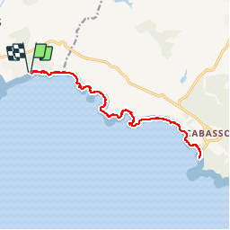

Length
18 km

Max alt
28 m

Uphill gradient
193 m
Km-Effort
21 km

Min alt
0 m

Downhill gradient
193 m
Boucle
Yes
Creation date :
2019-05-31 07:55:18.672
Updated on :
2019-05-31 18:06:56.846
5h57
Difficulty : Very easy

FREE GPS app for hiking
 SityTrail
IGN / Geographical institutes
SityTrail Plus
The world is yours!
About
Trail Walking of 18 km to be discovered at Provence-Alpes-Côte d'Azur, Var, La Londe-les-Maures. This trail is proposed by XavierFaidix.
Positioning
Country:
France
Region :
Provence-Alpes-Côte d'Azur
Department/Province :
Var
Municipality :
La Londe-les-Maures
Location:
Unknown
Start:(Dec)
Start:(UTM)
277097 ; 4777950 (32T) N.
Comments